MES-Survey
![]()
MES-Survey is a CAD & Earthworks software which can import points from ASCII (text) & compute earthworks volumes which is suitable to the use of Surveyors & Civil Engineers. It uses the latest computing technologies to provide a computational environment that is both users friendly, simple, fast and efficient.
MES-Survey is designed and developed for the engineers by the engineers. It comes with a rich and practical set of features that includes, but not limited to the following:
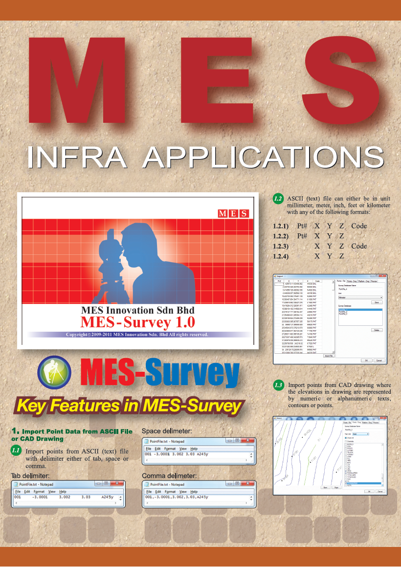
- Can import points from ASCII (text) file with delimiter either of tab, space or comma.
- ASCII (text) file can either be in unit millimeter, meter, inch, feet or kilometre.
- Import points from CAD drawing where the elevations in drawing are represented by numeric or alphanumeric texts, contours or points.
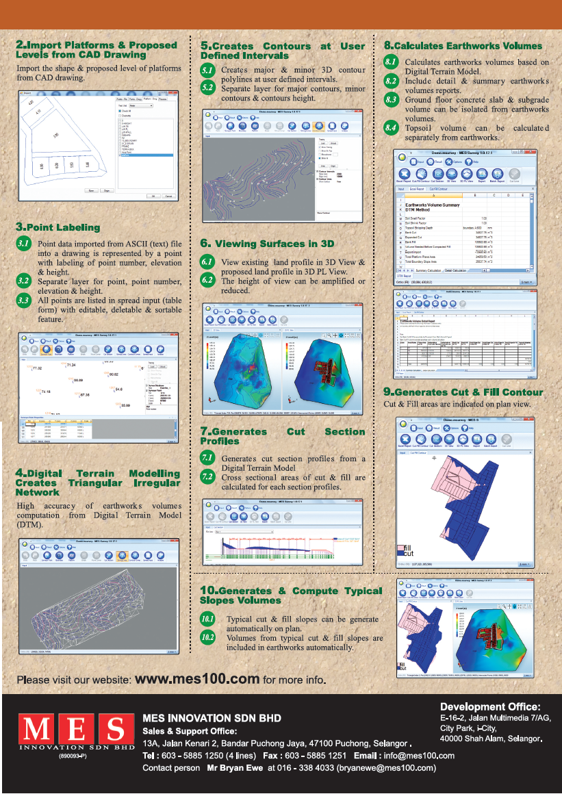
- Import the shape & proposed level of platforms from CAD drawing.
- Point labelling, e.g.: point number, elevation, height & code.
- Digital Terrain Modelling (DTM) creates Triangular Irregular Network.
- High accuracy of earthworks volumes computation from DTM.
- Creates major & minor 3D contour polylines at user defined intervals.
- Generates & Compute Typical Slopes Volumes.
- Auto sloping and berm generation with different cut/fill ratio for each platform.
- Generates Cut & Fill Contour.
- Auto balancing between cut and fill volume.